Remark
Please be aware that these lecture notes are accessible online in an ‘early access’ format. They are actively being developed, and certain sections will be further enriched to provide a comprehensive understanding of the subject matter.
1.7. Understanding Remote Sensing Images#
Remote sensing images are composed of pixels, which are the smallest units of a digital image. Each pixel corresponds to a specific area on the Earth’s surface and carries unique information [Richards, 1986, Natural Resources Canada, 2007]:
Digital Values: Pixels are assigned a digital value reflecting the intensity of captured radiation, which is used for analysis and interpretation.
Spectral Bands: Pixels capture light across various spectral bands, allowing us to detect different elements of the Earth’s surface based on how they reflect or absorb different wavelengths.
Color Composition: While a single spectral band can be represented in grayscale, combining multiple bands can produce a color image that reveals more details about the surface features.
This format is designed to distill complex information into key points that are easily understood, even by those new to the concept of remote sensing.
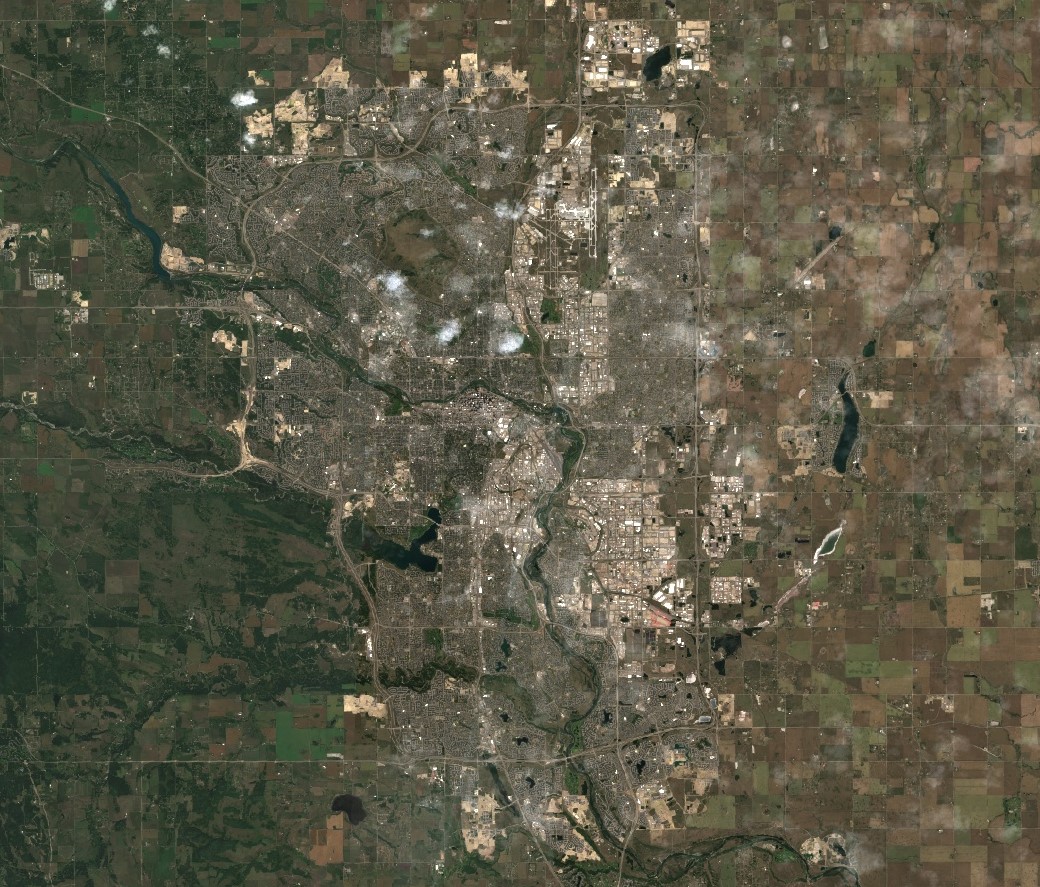
Fig. 1.22 The Red, Blue, and Green bands of Harmonized Sentinel-2 MSI: MultiSpectral Instrument, Level-2A, depicting the city of Calgary. Note: JPG format for web display. Image processed by H. Dastour using Google Earth Engine.#
1.7.1. Digital Representation of Photographs#
Photographs can be transformed into digital images by breaking them down into small, uniform sections known as pixels. Each pixel represents a specific portion of the image and is assigned a numerical value that corresponds to its brightness level. This numerical value is what allows a computer to display each pixel with varying degrees of brightness, effectively recreating the visual content of the original photograph in a digital format [Richards, 1986, Natural Resources Canada, 2007].
Process Overview:
Scanning: The physical photograph is scanned.
Pixelation: The scanned image is subdivided into a grid of pixels.
Digital Number Assignment: Each pixel is assigned a digital number based on its brightness.
Display: The computer interprets these digital numbers to display the image with appropriate brightness levels.
Unlike photographs that need to be converted into digital format, remote sensing sensors are designed to capture electromagnetic energy and record it electronically as an array of numbers from the outset. This direct digital capture is what forms the basis of remote sensing imagery.
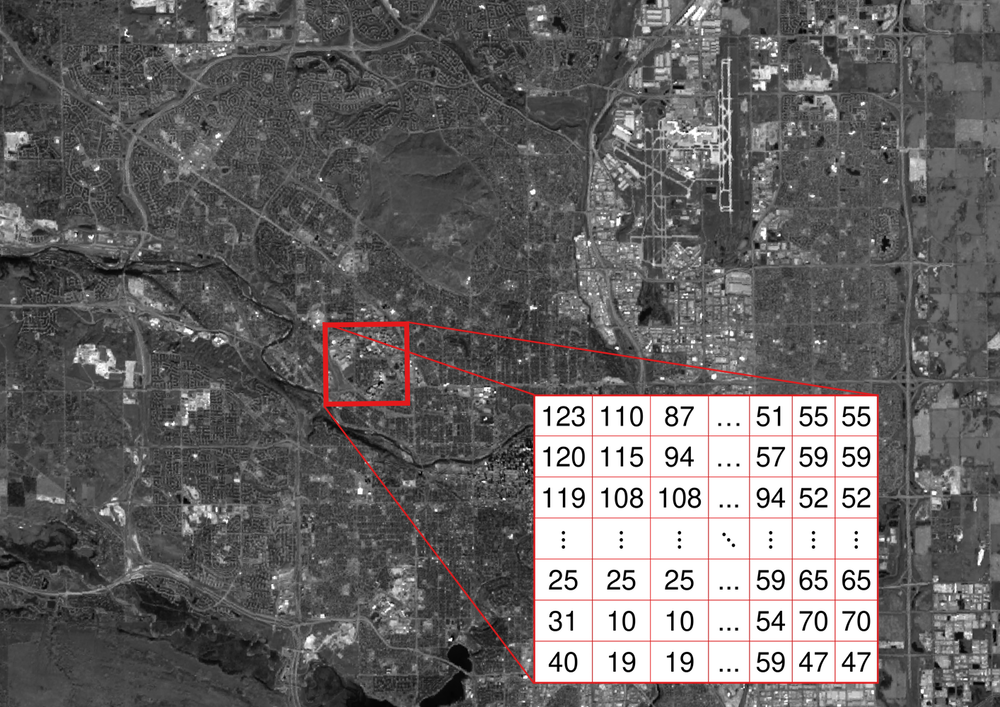
Fig. 1.23 A visual representation of how digital images are encoded as numerical arrays, known as matrices. Each pixel’s grayscale value is captured in the matrix, ranging from 0 for black to 255 for white. This translates the visual information into a format that computers can process and analyze. This matrix is fundamental in image processing and analysis, allowing for the manipulation and interpretation of image data. Red band of USGS Landsat 8 Level 2, Collection 2, Tier 1 image depicting the City of Calgary. Source: USGS, processed by H. Dastour.#
Both pictorial and digital representations of remote sensing data are interchangeable, as they contain the same information. However, it’s important to note that some detail may be lost when converting between the two formats.
Advantages of Digital Images:
Manipulation: Digital images can be easily edited and enhanced.
Storage: They require less physical space and are more durable than physical photographs.
Transmission: Digital images can be shared quickly and efficiently over networks.
The digital representation of images is a fundamental aspect of modern imaging technology, enabling detailed analysis and processing for a wide range of applications, from environmental monitoring to medical imaging.